Floating through Time
Outdoor Heritage Centre
Visit our website here

Thursday, 29 November 2012

Wood and Water

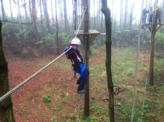
Last week we were off-river. For a change we were in the middle of a forest beside a lake, so we weren't totally on dry land. The location was Drewstown Woods and we were doing a High Ropes Intructor Course. A lovely spot, and all the Beech and Pine trees got me thinking about woodland and wetland archaeology, which is a bit of a contrast to the rolling green mounds and prehistoric art that you would normally associate with the Boyne Valley.

Hanging around
Something must have been in the air because this week saw the release of some amazing pictures from the Drumclay crannog in Fermanagh which was saved from the bulldozer by archaeologists. This got me thinking of the crannogs in the Boyne Valley. Crannogs get their name from the irish for "tree" and they were usually built by driving large wooden piles into waterlogged areas and then building up the interior with brushwood, peat, stones and soil to create an artificial island. Architecturally, lake dwelling spaces are a worldwide phenomenon and are still in use in some cultures today. There are over 1500 of them listed in Ireland. Two of the best known are located in the Boyne Valley.
Moynagh Lough is located near Nobber on the edge of a former lake by the River Dee. It was excavated during the 80s and evidence was found from prehistoric periods along with early history. However, it was the early medieval period (700-900AD) that produced the most evidence for settlement. A range of high status items such as brooches were found here and they were created from different materials including gold, bronze, jet, amber, glass, horn and iron. Some of these items were found in the waste disposal area of the site so there was obviously plenty of material going spare. The presence of bowl furnaces also suggest that this crannog was used for the mass production of objects and many of these were ecclesiastical in nature. Due to the anaerobic conditions of the site there was also a great many items discovered which would normally not survive in the record, such as leather shoes and wooden utensils. Sites like this tell us a lot about everyday life back then because during that period, pottery was rare in Ireland.
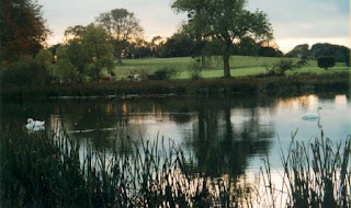
Drewstown Lake
On the other side of the Boyne Valley is another famous crannog. Lagore is located near Dunshaughlin and according to the historical sources, this was the home of the Southern Brega who were a warlike bunch that liked nothing better than persecuting the Norsemen in Dublin and the Northern Brega based at Knowth. The evidence found at Lagore include iron slave collars, drinking containers made from human skulls and more iron than bronze. They also liked to use human bones in the foundations of the island, and these may have been workers that paid the ultimate sacrifice. Industrial activity from Lagore was primarily agricultural with ploughs, spindles and game pieces turning up.
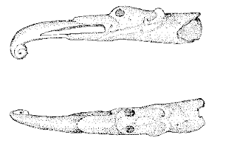
Drinking Horns from Moynagh Lough Crannog
So, in a time when there were no towns in Ireland, we have people organising the building of wooden stilted settlements near water. The evidence suggests that they were located here for particular reasons. They may have been to do with manufacturing, or status, or defence. The ongoing work in Fermanagh will hopefully build on what we have learned in the Boyne Valley.
In the meantime, I have some branches to chop.
Credits
Crannogs
Scott, B G 1978 `Iron 'slave-collars' from Lagore Crannog, Co Meath' Proc Roy Ir Acad C 78, 1978 213-30,
Bradley J. Excavations at Moynagh Lough County Meath, The Journal of the Royal Society of Antiquaries of Ireland Vol. 121, (1991), pp. 5-26


Sunday, 4 November 2012

Thursday, 1 November 2012

Halloween

Halloween, or Samhain (Summers End) in the Boyne Valley was originally celebrated as the end of the old year and like a modern day New Years Eve, it is a bit difficult to decide which is the best party to go to on the night. While the urban areas of the Boyne Valley see the continuation of old rituals such as fires, guising (costumes), divination (apple bobbing) and mischief (teenagers roaming the streets), the rural areas are just as busy.
This is not a new phenomenon. Ireland was a rural landscape up until the 20th century and this time of the year is important for country people. The animals would be brought in from the fields. Slaughtering would take place and feasts would be had to fatten up for the dark cold nights coming. This was the last chance to gather fruits or grains before the frosts killed them and the land descended into darkness. Travelling workers returned to their own families. Fires were lit. And of course, the fairy folk were able to slip through the veil between the worlds without the usual spiritual immigration laws that operated the rest of the year.

Up at Loughcrew, the passage mound at Carnbane L has an unusual standing stone within it which is illuminated by the sunrise at Samhain. Cairn U is also supposed to be aligned with the sunrise. The Mound of the Hostages on Tara is another landscape marker aligned with the Samhain sunrise and like Carnbane L, there was a standing stone at its entrance up until the 19th century.

The Mound of the Hostages dates from the neolithic and there is a lot of archaeological evidence for a ring of fire pits around it. The earliest historical records from here mention the lighting of the fires at Tara to signal the start of the New Year. Everyone waited for the signal from Tara, but the high king at Tara got his signal from the druids at Tlachtga, which goes by the name of the Hill of Ward today. While Tara was seen as the political capital, Tlachtga was seen as the spiritual centre for the druids and it is there where the biggest party was last night.

Flame torches and flourescent lights circled this unusual multi-ditched site while a procession made its way up from the fair green in Athboy. Modern day druids rubbed shoulders with Wiccan practitioners and children in masks and elderly farmers out to mark All Hallows Eve, the christian version. There was even a film crew from Korea and when the ritual pageant of the story of Tlachtga started I kept expecting Halloween "Gangnam" style but it was a classy affair, about Tlachtgas search for knowledge and the idea of sharing that knowledge rather than using it to control others. Nice sentiments, followed by tea and crisps.

This mix of different styles and old tales is typical of Tlachtga. Ongoing remote sensing surveys on the hill are revealing that there is a lot more going on under the ground than we can see. There are only three sites like Tlachtga in Ireland and one of them is the Rath of the Synods in Tara so there definitely seems to be a link with the royal site here. Whatever it was originally used for (nobody even knows if the hill of Ward is actually Tlachtga!), it still draws a crowd on Halloween.

Credits

knowth.com

wikipedia

newgrange.com

ucd

tlachtga

Image credit

facebook

facebook

shadowsandstone.com

Friday, 19 October 2012

The Romans of the Boyne Valley

With the news this week that a roman statue of Hercules was found in the National Museum after being missing for over a hundred years and it turns out that it was originally found in the Boyne river near Navan, the question is raised again about whether or not the Romans ever came to Ireland. Coincidently, the Discovery Programme are hosting an international conference this weekend about the Romans in ireland, so the find is well-timed and should get the archaeologists rubbing their trowels with happiness.


While Roman artifacts are rare enough, they do pop up quite a lot in the Boyne Valley and all along the East Coast. It seems that the peoples of the Mediterranean were quite knowledgeable about this area during the period when Rome was a superpower. The first recorded historical reference to the Boyne was on a map in a museum in Alexandria by the philosopher Ptolemy which dates from around 150AD. This map was very accurate (even though it referred to Boyne as Buvinda) and it would have probably have been drawn by Phoenician traders.

The Roman historian, Tacitus, referred to Ireland as being easily invaded by just one legion, yet unlike the rest of Europe, there is no military or even settlement activity discovered yet.


Plenty of trade though. Apparently, the Romans were fond of our wolfhounds. Pottery dredged from the Boyne and from Collierstown have been traced back to Syria and Turkey and they were most likely used for transporting oil and wine. Artifacts found at Tara suggest that there was a Roman trading post here during the Iron Age. At the entrance to Newgrange were found high status Roman coins that were deliberatley deposited there, raising the suggestion that the mound was an international pilgrimage site for them. There was also a roman brooch found in a holywell at Randalstown which was probably another votive deposit.
Burial-wise, there are some definite Roman examples along the east coast. Cremations in Kilkenny are similar to the romano-british style from around 100AD. In Bettystown in the 70s, some very strange burials were found. They were treated differently than others in the area and with the progress in geochemistry in recent years we can tell lots more about these bodies now. Isotope analysis of their tooth enamel places this person as growing up in a very specific part of North Africa around 500AD. You have to remember that the empire was made up of a melting-pot of different ethnic groups at the time. Citizens included visitors from across the Irish Sea and they would have been quite different than the toga wearing beaurocrats we normally think about when we talk about Rome. Patrick was one of those citizens and despite the lack of traditional Roman archaeology found here, christianity was a direct import from Rome to Ireland. So the question is not what the romans have ever done for us, it is more what were they doing here while they were here.

Sources

http://de.wikipedia.org/wiki/Datei:Ptolemy_Cosmographia_1467_-_Ireland.jpg

http://www.irishtimes.com/newspaper/features/2012/1017/1224325323956.html

http://irisharchaeology.ie/2011/11/roman-contacts-with-ireland/

Raftery, B. 1994 Pagan Celtic Ireland: the enigma of the Irish Iron Age. Dublin.

Waddle, J. 1998 The Prehistoric Archaeology of Ireland, Wordwell, Dublin.

Sunday, 7 October 2012

Best thing since before sliced bread...

This week saw the sad closing of one of the Boyne Valleys oldest food processing companies, Spicers Bakery. Navan is where the Blackwater and the Boyne meet and this mix of rushing water has been used for centuries to power different industries, and perhaps the most important of these were the water-mills. The first water-mill in Ireland was supposedly built by King Cormac Mac Art in the Boyne Valley in the 2nd century AD. His favourite concubine was in the bad books with his jealous wife and she was ordered to grind the grain for the whole royal site of Tara. This is why Cormac had the mill built. These were revolutionary machines when you think that rural people still used the more ancient stone quern method of grinding grain into flour right up until the early 20th century. Mills were referred to by historians as "the backbone of Irish industry". Although the present Spicers bakery  was originally the cornstore for the mill, it is still an impressive building. It is a detached six bay four story construction with exposed rubble walls that are whitewashed and which dates from the 1860s.


The mill itself was converted to apartments during the last boom era and it is ironic that it was built in a previous boom. At the time (1785) it was one of the biggest mills in Ireland and it required a considerable amount of capital investment to build these. Records show that there were ten pairs of stones in the original mill, six for wheat and four for oats. The video below shows a typical working water powered flour mill from the Blackwater area.


This large investment was low-risk because bread was fast becoming the staple diet for the new urban workers during the industrial revolution. Before that, bread had been a luxury. The Napoleonic Wars also meant that Britain was dependent on Ireland for its bread. This was why the Irish parliament offered 3d per mile to transport flour to Dublin. This was over twice the price for wheat. Meath was the first county to start sending flour to the capital and this helped its transport infrastructure grow. The Boyne Navigation Canal is a good example of this and it was owned by Spicers until the 1960s. Milling was a profitable business during the 19th century, with over 2500 recorded as being built between 1835 and 1850 in Ireland. There was a downside to this though. Millers wanted all local grinding to be carried out in their mills. That is why we find so many smashed stone querns reused in stone walls and dumped for archaeologists to find. The milling industry also demanded economic protection from the cheap imports which were being processed in the giant mills of Chicago and the American West. This they got, courtesy of the Corn Laws, and they made a killing from it. Unfortunately, the corn laws were not such a good idea during the famine. Eventually, cheap white bread began to flood the market in the 1880s and this heralded the death knell of the mills.
Spicers changed from a mill to a bakery in 1880 and they had depots in Trim and Balbriggan aswell. During the 1970s they employed over 300 people and generations of Loreto convent girls who went to school across the road from the bakery have never forgotten memories of the smell of fresh bread while they studied.


Saturday, 29 September 2012

The Trim Incident

This weekend in 1920 was busier than normal in Trim.
The War of Independence was in full swing and the IRA were concentrating on attacking RIC barracks. The Royal Irish Constabulory were the main method of control in Ireland by the British government at the time and the barracks in Trim was a formidable establishment. It had over 20 men stationed there and contained guns, ammunition and grenades. It was located in what is now the Castle Arch Hotel and it had walls and steel gates that were over 15ft high.


The Meath IRA hatched a plan to attack the barracks on Sunday because they knew that half of them would be gone to mass. The IRA was very active in this area and one of the Lalor brothers had already single handedly attacked a truckload of soldiers at the Wellington monument
They blocked off the roads to Trim, captured the constables in the church and attacked the barracks. Only one constable tried to stop them and he was shot in the lung. Then the building was burned down using oil that they brought with them. The IRA escaped and went into hiding. One of them was said to have hid in a freshly dug grave.


They had to hide because they knew that the Black and Tans would arrive soon. The British government had a strategy for dealing with guerilla warfare since the Boer War. Reprisals. Four lorries of Black and Tans arrived and shot into a crowd hurling on the fair green, injuring two boys, George Griffen and James Kelly. The local priest and town leaders intervened and pleaded with the auxillaries not to take it out on the town. They drove off but returned in the early hours of the morning. This is when the madness started.
Witnesses say that the town was left looking like something from the war-fields of France. A quarter of the buildings were burned, including J&E Smyths, right beside where our premises are now located, and the town hall with all the town records. Soldiers waved grenades in front of windows where children hid. For years afterwards, children were forbidden to play with toy guns in the street because so many of them were traumatised. Many of the townsfolk left their homes and hid down by the river, rather than suffer the reprisals.

The looting and burning by the Black and Tans was reported in the New York Times and on the British Pathe newsreel. It had two significant consequences. The IRA in Meath became the centre of the Eastern force in Ireland, and General Crozier, the leader of the Auxillary British Forces, was forced to resign over the actions of his forces in what was called the Trim Incident.After the War of Independence, quite a few of the volunteers that took part on the raid of the RIC barracks went on to join the newly formed police force, An Garda Siochana

Monday, 24 September 2012

Mountain of the Witch

This weekend we travelled north of the Boyne to visit Sliabh na Cailleach, which has some of the oldest free standing monuments in the world. Otherwise known as Lough Crew, the dates from the mounds place us in the neolithic (about 3200BC), although there is evidence from the mesolithic here also. Lough Crew is the lesser known of the four great neolithic passage mound landscapes in Ireland, but it has an equal range of monuments, from passage mounds to standing stones and stone circles. Bru na Boinne is where the tourists flock to but there are many who prefer the quiet loneliness of Lough Crew. Carrowmore and Carrowkeel rise dramatically out of the Sligo landscape overlooking the Atlantic, but Lough Crew appears to be gentle, leading some commentators to reflect on its feminine style.
Like many other monuments in the Boyne valley, it is not high. Cairn T, at 276m above sea level, is about a ten minute climb from the car park below. It is still the highest point in Meath and the views from here this weekend, take in 18 counties. You can see here from Tara on a good day. Indeed, cairn T is noticeable from all around and, like Newgrange, it was originally covered in quartz. You wouldn't have missed it in the landscape. You would be forgiven for thinking that you are much higher. Neolithic hill landscapes are like that. They maximise their height effect and the hilltops here often rise out of the mists below like they were reaching through clouds. Archaeologists refer to them as "islandscapes". There is a possibility that places like this were more associated with the sky than the land, and this is obvious with cairn T.

Lough Crew is made up of a range of hills but everyone is visiting Cairn T this weekend because it is the time of the Autumn Equinox and the backstone in this cairn will be lit by the rising sun. This is the time of the year when the sun moves around the sky at great speed, unlike the more relaxed way it hangs in the sky during the solstices. There are exactly twelve hours of day and twelve hours of night during the equinox. This is when the kids start to grumble that it is getting dark in the mornings. From here on in, the days get noticeably shorter and this is traditionally the last chance to bring in the harvest. Any later than this and you run the risk of the crops rotting in the cold ground. The sillstones and passage of the mound carves out the sunlight into a rectangle shape which moves around the backstone as the sun moves in the sky. The famous equinox stone is covered in megalithic art and the light seems to follow the flower designs more than any others. There are also serpentine forms, spirals and cupmarks that appear to have been formed by rubbing stone balls into holes. The theories about the art tell us more about the theorists than the truth but the similarities between the art here and other ancient cultures such as the native Americans or the Australians is obvious.

The cairn was supposedly the burial place of Ollamh Fodhla, the great lawgiver King of Tara. There is doubt about that but it is definitely associated with the cailleach, or the veiled one. Modern western society would class a cailleach as a witch but it could have just as easily meant a wise woman. Local legend (and I always go with that) states that the cairns were formed when the cailleach was jumping across the hills with stones in her apron in order to achieve great power. More likely, the cailleach is the Irish triple goddess made up of the maiden, the mother and the bone lady. A megalith on the north side of the passage mound is called the Hags Chair and this is where she liked to sit and look out over her territory to the North.
This could have just been agricultural legends based on the coming change of the seasons, or it may actually have been based on a strong local female personality from prehistory. Burials associated with the Cailleach Beara in Munster are predominantly female so there may have been a tradition of strong female leaders back then. The hills of Sliabh na Cailleach, like those of the Kerry Paps, lend themselves to the shapes of breasts, so they could also have been used to refer to the earth goddess. There are many theories out there. What do you think?